


Dede Suhendar, 2025
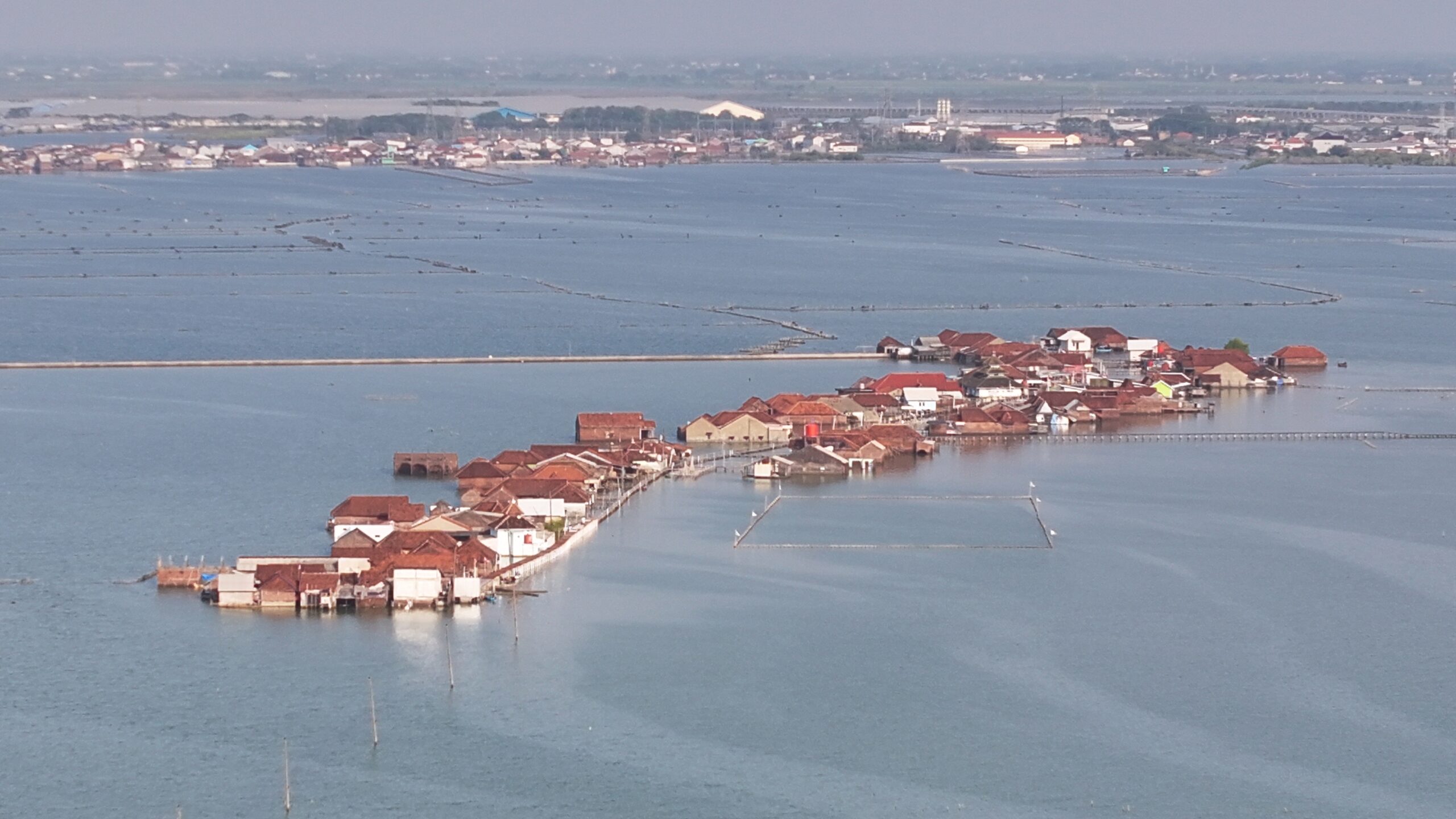
Ecotone is defined as a transitional zone in between two adjacent ecological systems. The Northern Coast of Java Island, Indonesia, is an example of ecotone where terrestrial and marine environments converge to form a unique and dynamic ecological system. Building upon the term ec(h)otoning that amplifies the concept of utilizing ecotone as a lens in identifying Wicked Urban Problems (WUP), this project aims to examine the coastal ecotone in Semarang-Demak, Central Java, Indonesia. By showcasing the changes in the transitional area between land and sea, and differences from Semarang urban fabrics to Demak rural landscape, this project will help on depicting how rich and dynamic characteristics can create interconnected problems that cause environmental degradation and disruption to communities’ livelihood. This will provide insights and spark discussions in developing integrated strategies and management approaches to support SDG 11. This project is designed to visualize the shifting dynamics and adaptation measures to Wicked Urban Problems in Semarang-Demak coastal ecotone areas by employing temporal storytelling using digital interactive platforms, displayed through Ecotone Time Map, a feature storytelling video, and a virtual reality media (VR). These outputs will be presented through an exhibition event, with students and researchers as the target audiences.
Developing this ecotone timemap will illustrate the environmental, physical, and socio-economic changes in coastal ecotone areas over time due to climate change. This spatial method combines scientific data, local knowledge, and interactive media to communicate complex ecological changes in an accessible, participatory way.
Overview of Ecotone Time Map

Created by A. Alam Samudro Wicaksono in 2025
Field Survey at Timbulsloko Village, Sayung Sub-district, Demak Regency

Photo Juan Ramadhan, 2025

Iwan Rudiarto – Lead Partner

Nurul Hasfi

Wiwandari Handayani

Santy Paulla Dewi

Astrini Ayu Puspita

Retno Sari Dewi

Tia Dianing Insani
Elisa Rahma Putri
Citra Tatius