Out in The Field: Trailing into Geomorphology
In Indonesia, the team focused on three key study locations along the northern coast: Jakarta (Muara Angke), Pekalongan (Wonokerto), and Gresik (Ujung Pangkah). Each site provided diverse exposures that deepened the understanding of urban planning, humanities, and their complex interactions with the environment. Muara Angke, located in Pluit Sub district, Penjaringan District, North Jakarta, is one of the coastal resilient kampung amid Jakarta’s rapid development. The fishing settlements in this area reflect the dense coastal community life with its infrastructure and environmental challenges, while TPI Muara Angke serves as an economic hub where marine catches are traded. Meanwhile, floating houses in this region, emerge as a solution to the limited availability of decent housing and the issue of tidal flooding.
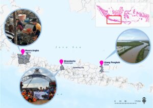
Figure 3. Map of Field Visit Location in the Northern Coast of Java Island, Indonesia
Wonokerto, located in Pekalongan Regency, is a sub-district situated in the northern part, directly bordering the Java Sea. It is one of the coastal areas severely impacted by climate change. The team, along with undergraduate and postgraduate students from UNDIP, observed the impacts of land subsidence and erosion in Wonokerto and the adaptations made by the local community.
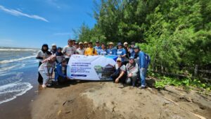
Figure 4. Field Visit to Wonokerto, Pekalongan, Indonesia
The final case site of Indonesia was Ujung Pangkah, a delta formed at the mouth of the Bengawan Solo River. As one of the largest deltas in East Java, this area is an important habitat for coastal wetland ecosystems. The main estuary of Ujung Pangkah consists of three coastal villages: Pangkah Wetan, Pangkah Kulon, and Banyuurip. The team focused on the mangrove areas, which play a crucial role in protecting the coastline from abrasion and maintaining the stability of the local ecosystem.
In India, the Indonesian team visited two major case sites, the East Kolkata Wetlands a peri-urban ecosystem of the city and Kumirmari island in the Gosaba block of Indian Sundarbans. Both sites reflected the intricacies and interconnections of urban-nature, socio-cultural and infrastructure-community resilience in a risky deltascape. The visits to the East Kolkata Wetlands explored the historicity of colonial hydrology in crafting the vital ecosystem and its interdependency with the city, the role of canal infrastructures in the everydayness of the wetlands and its vitality in Kolkata’s survival. The visit to Kumirmari village, which is one of the remotest islands amidst the dense mangrove delta of Indian Sundarbans, exposed the team to the ongoing inland fishing experiments in the island, which is co-conducted by the inhabitants and IIT researchers, as a traditional form of social resilience against concurrent embankment breaches by cyclones and floods. The team stayed in the village premises, partook in mapping of community ponds, critical development of questionnaires, stakeholder engagement and planning for future strategies with the local inhabitants. The team also witnessed the community’s ‘artivism’, where the inhabitants disseminated their agency through pala gaan, a traditional Bengali artform of music and poetry, showcasing their research engagement to a wider audience.
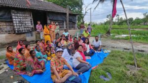
Figure 4. Field work in Kumirmari, Indian Sundarbans
